With the lavender fields near Gordes and art/architecture of Arles behind us, day three of our adventures in/around Provence began with a drive out to Pont du Gard. For those of you who are unfamiliar, it’s the highest and best preserved of all elevated Roman aqueducts and was added to the UNESCO World Heritage list in 1985.
What interested us about this spot? Well, I have to admit as I was researching I was intrigued to find such a Roman ruin here in France. What’s more, one that boasted being similar in height to the Colosseum in Rome. Impressed by the engineering as well as size and only 30 minutes away from Arles, I had to see it for myself.
It was a quick ride from Arles toward Nîmes with a bit of heavier than usual (I’m assuming) traffic flow and some backed up roundabouts, I presume due to the music festival in Nîmes that evening. We made our way to Pont du Gard around 10am or so. It was a clear and hot/steamy day. We parked not far from the Visitor’s Center, which we were a bit surprised to see. Apparently a visitor’s center was built in 2010 and this is an incredibly popular French tourist destination (Rick Steves sure didn’t mention any of that in his book). What’s more, you can really make a whole day of it visiting Pont du Gard including camping, hiking, swimming in the Gardon River with the aqueduct behind you, etc.). Unfortunately, we didn’t know any of this. We thought we’d just drive up, run down and snap some photos/investigate, and then be on our way. In reality, it’s a much bigger production. While I think it was a little too hot for hiking (or camping) in early July, I think during the springtime it’d be absolutely gorgeous.


As such, we purchased our tickets, which allowed us the opportunity to view the cave (not a very big one), access to the museum, and walk along the bridge/aqueduct. Yes, I said walk along (something else I didn’t know beforehand). I was really impressed they would let us walk on the ruins and that with that walking the aqueduct was still in such great shape. Then we approached and I realized where we were walking wasn’t exactly part of the ancient aqueduct. After some investigating, we found out this used to be a toll bridge from the fall of the Roman Empire up until the end of the 17th century.


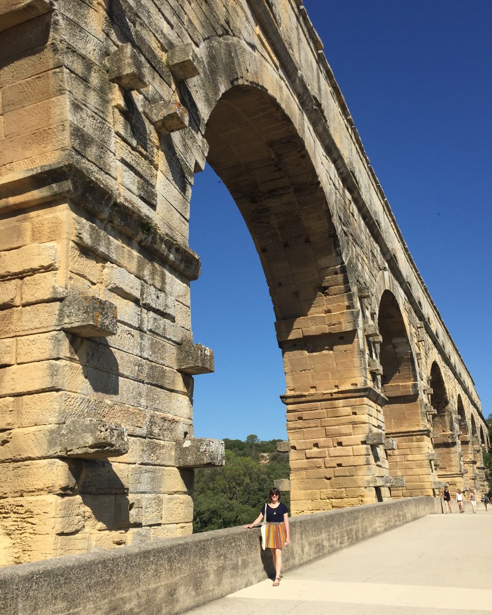
Another amazing thing was the size of the arches and individual stones. “The bridge has three tiers of arches, stands 48.8 m (160 ft) high, and descends a mere 2.5 centimetres (1 in) – a gradient of only 1 in 18,241 – while the whole aqueduct descends in height by only 12.6 m (41 ft) over its entire length.” Wow. Roman engineers amaze me. Additionally, how on earth did they build this? How did they know how to build it. It’s just astounding/amazing. In the photo below you can see me standing in the middle of the arches, which gives a little perspective.
Since we didn’t bring any swim suits and had plans to drive the Côtes du Rhône wine trail later that day, we enjoyed the space (and the sycamore trees), purchased some water for the road, and continued on our journey.
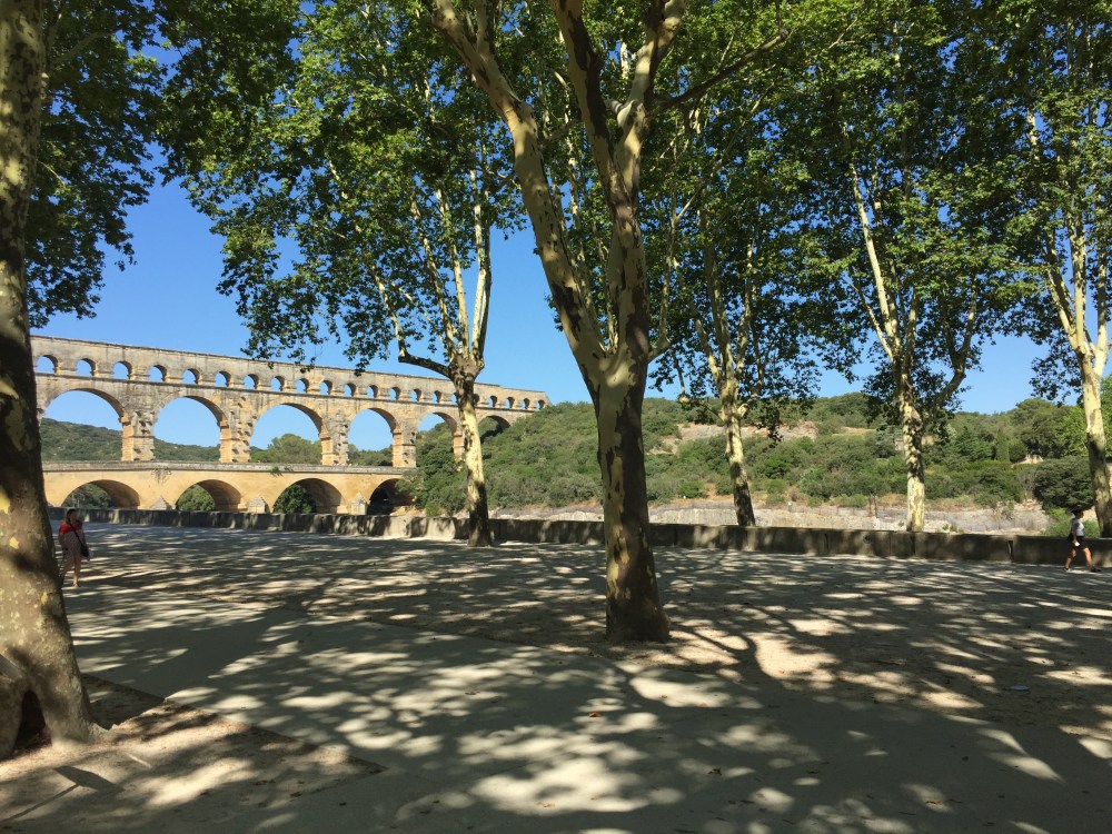
If you do find yourself wanting to explore this spot, please know it’s much bigger and impressive than a guidebook might lead you to believe. You could easily take a day (or two) swimming or even taking an early morning hike. Additionally, the area is surrounded by absolutely gorgeous sycamore trees. If you love a road that’s hugged by large, old trees…this is an area of France made just for you.

2 Comments Add yours